Overview
The article titled "Understanding Lake Michigan on a Map: Features and Significance" underscores the remarkable geographical features and historical importance of Lake Michigan, as well as the diverse mapping styles employed to depict it. Lake Michigan stands as a vital resource, playing significant ecological, recreational, and economic roles, all supported by its unique geographical characteristics and rich historical context. These elements have profoundly shaped the region's development and cultural landscape, inviting readers to appreciate its multifaceted significance.
Introduction
Lake Michigan, a remarkable jewel among the Great Lakes, presents a distinctive combination of geographical features and profound historical significance that captivates both locals and visitors. This vast body of water is not merely a vital resource for recreation and commerce; it also plays an essential role in shaping the cultural and economic landscape of the Midwest.
But what lies beneath the surface of its shimmering waters? By exploring the intricate mapping styles and representations of Lake Michigan, we uncover a deeper understanding of its ecological importance and the narratives it holds. This prompts us to consider how this magnificent lake continues to influence the region today.
Define Lake Michigan's Geographical Features
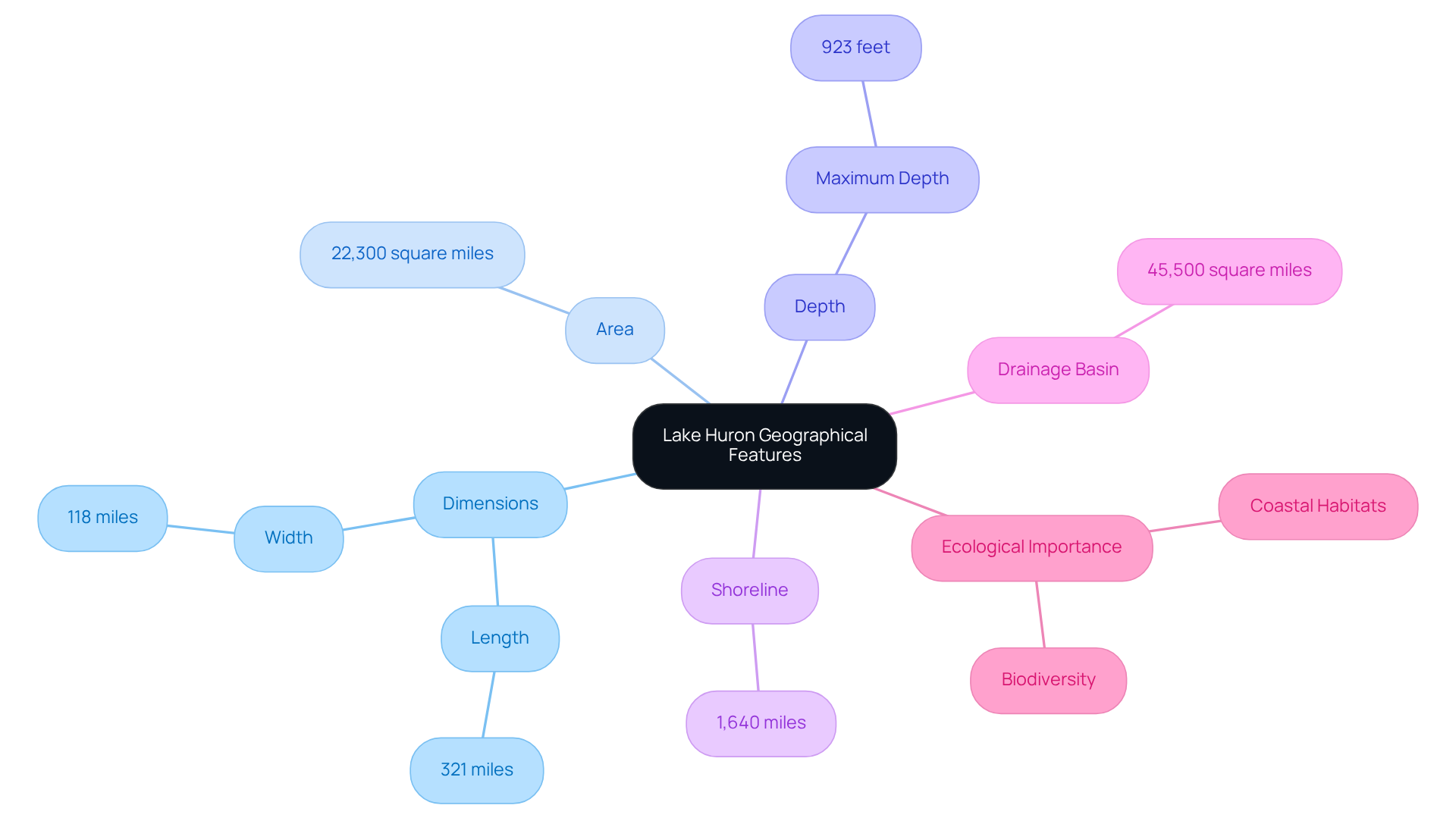
Lake Huron stands as a remarkable entity among the five Great Lakes of North America, uniquely positioned as the only one entirely within the United States. Stretching an impressive 321 miles (517 km) from north to south, it boasts a maximum width of 118 miles (190 km). This expansive body of water encompasses approximately 22,300 square miles (57,757 square kilometers) and reaches a significant maximum depth of 923 feet (281 meters). With a shoreline measuring about 1,640 miles, it features sandy beaches, dunes, and a variety of coastal habitats that enhance its natural beauty. The lake's drainage basin, covering roughly 45,500 square miles (118,000 square kilometers), integrates regions from four states: Wisconsin, Illinois, and Indiana. These geographical characteristics not only define the physical presence of Lake Huron but also underscore its ecological and recreational importance, making it a vital asset to the region.

Explore the Historical Context of Lake Michigan
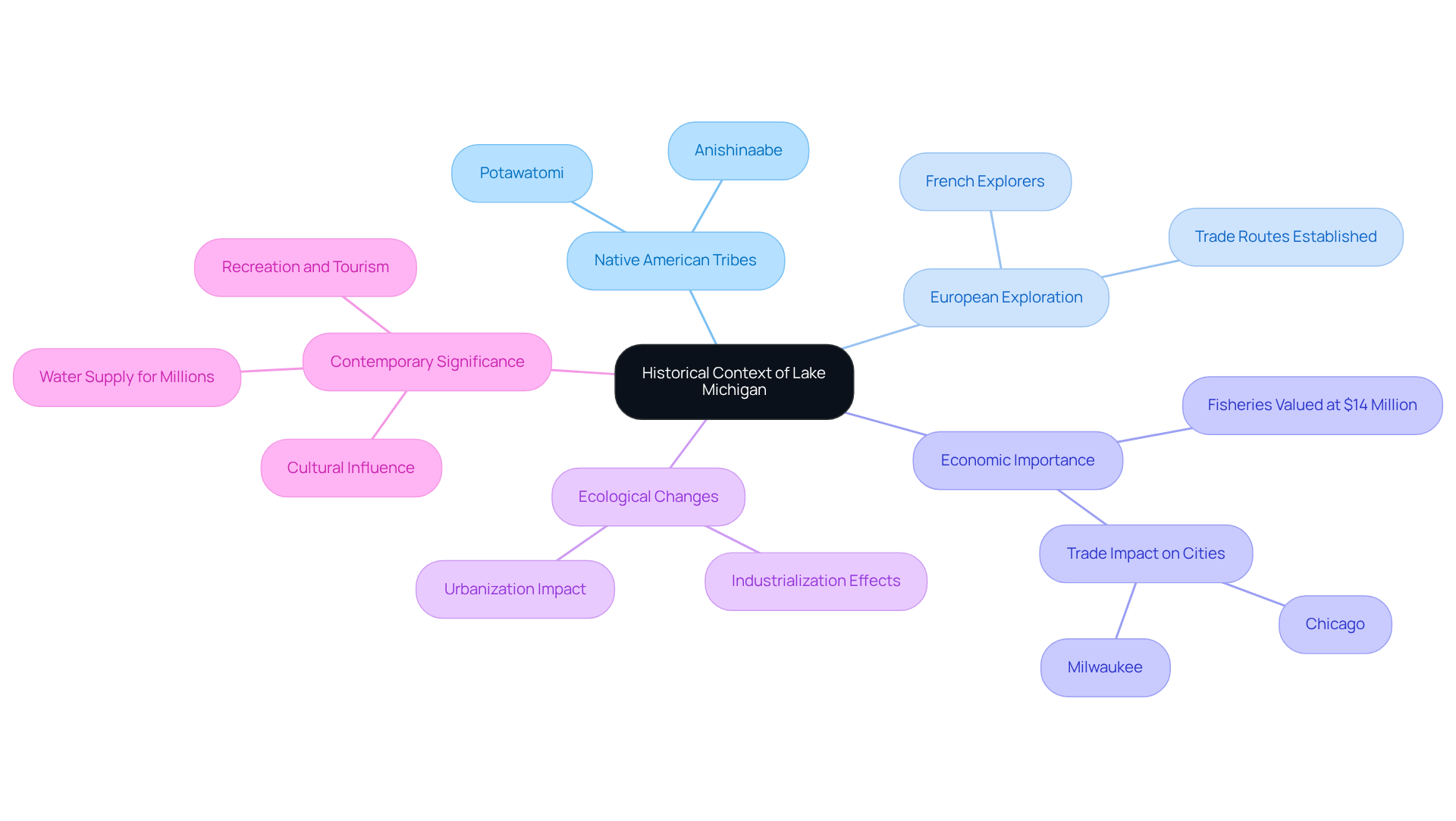
This lake boasts a profound history that spans thousands of years, with Native American tribes such as the Anishinaabe and Potawatomi residing along its shores long before European explorers arrived. The name 'Lake Huron' derives from the Anishinaabemowin term 'mishigami,' which translates to 'great water.' In the 17th century, French explorers and traders began traversing this body of water, establishing essential trade routes that significantly impacted the area's economy. This waterway was instrumental in the growth of cities like Chicago and Milwaukee, serving as a crucial transportation hub for goods and people.
The historical significance of this body of water is underscored by its role in establishing trade networks and bolstering the economy of the Midwest. By the 19th and 20th centuries, industrialization and urbanization transformed the surrounding areas, resulting in notable ecological changes. For instance, the lake's fisheries were valued at approximately $14 million in 2001, underscoring its economic importance. Furthermore, the Great Lakes provide water to one-third of Canadians and one-seventh of Americans, highlighting the larger significance of this body of water as an essential regional resource.
Today, this body of water continues to serve as a vital resource for recreation, tourism, and commerce, reflecting its enduring legacy in shaping the region's cultural and economic landscape. As Yasmina Haque aptly describes, "Lake Michigan’s definitely moody. It’s not just bi-polar, but beyond schizophrenic," capturing the unpredictable nature of the water. With around 12 million individuals residing along its shores, this body of water remains a central feature of life in the Midwest, embodying both historical and contemporary significance.

Identify Key Characteristics of Lake Michigan on Maps
Maps of Lake Huron stand out due to their unique characteristics, including size, depth, and surrounding landforms. Topographic representations showcase the lake's contours and elevations, highlighting remarkable features such as the Indiana Dunes and the rugged shoreline of the Michigan coast. Bathymetric charts delve deeper, offering intricate details about the lake's underwater topography, revealing submerged ridges and valleys. Additionally, thematic representations focus on ecological aspects, including fish habitats and recreational zones. These maps are vital for various stakeholders—environmentalists, fishermen, and tourists alike—as they provide essential information for navigation, conservation, and leisure activities.
Custom handcrafted 3D representations from Pangea Maps elevate these characteristics into a personalized format. Each map is meticulously hand-sketched over bathymetry and framed locally, resulting in not only meaningful gifts but also exquisite decorative pieces that reflect personal adventures. Designed to capture your unique story, these maps celebrate significant memories with craftsmanship that resonates emotionally. Inquire today to explore how these maps can enhance your connection to Lake Huron and serve as a remarkable addition to your collection.
Examine Mapping Styles and Representations of Lake Michigan
The styles of mapping for Lake Michigan on a map are impressively diverse, each meticulously tailored to specific purposes and audiences. Conventional paper charts offer a distinct illustration of the water body's geography, showcasing roads, towns, and natural features. In contrast, digital charts significantly enhance user experience with interactive capabilities, enabling users to zoom into specific regions and access real-time information.
Artistic representations, such as those crafted by Pangea Maps, transform the lake into an exquisite piece of art, celebrating its beauty and significance through custom designs that often weave in personal stories or cherished memories. These artisanal handcrafted 3D maps, featuring hand sketches over bathymetry and locally hand-glued and framed, serve as exceptional gifts for special occasions.
Pangea Maps places a strong emphasis on craftsmanship and customer service, ensuring that each piece is not only a beautiful work of art but also a treasured keepsake. Their fast custom design service, typically completed within an hour, alongside production times of 3 to 8 days, highlights their efficiency and responsiveness, distinguishing them from competitors by delivering unique, personalized experiences.
Nautical charts, on the other hand, are indispensable for mariners, providing critical information about water depths, navigational hazards, and safe passage routes. Each mapping style fulfills a distinct role, catering to the varied needs of users while celebrating the beauty and importance of Lake Michigan on a map. Inquire today to explore the perfect map that captures your unique story.
Conclusion
Lake Michigan stands as not merely a significant body of water; it embodies a complex ecosystem and a cultural landmark that has profoundly influenced the history and economy of the Midwest. This article has delved into the lake's geographical features, historical context, and the diverse mapping styles that underscore its importance. A thorough understanding of Lake Michigan on a map reveals not only its physical dimensions but also its critical role as a vital resource for the millions residing along its shores.
Key insights encompass the lake's impressive size and depth, its ecological diversity, and its historical significance as a trade route that propelled economic growth in cities such as Chicago and Milwaukee. Furthermore, the article highlights the significance of various mapping styles—ranging from traditional charts to artisanal 3D representations—each serving distinct purposes for diverse audiences. These maps are indispensable tools for navigation, conservation, and recreation, showcasing the multifaceted nature of Lake Michigan.
Reflecting on Lake Michigan's significance emphasizes the imperative for ongoing appreciation and stewardship of this vital resource. Whether for recreational pursuits, tourism, or ecological preservation, grasping the lake's features and historical context is paramount. Engaging with Lake Michigan—through exploration, education, or simply savoring its beauty—ensures that its legacy will endure for generations to come.
Frequently Asked Questions
What is the geographical significance of Lake Huron?
Lake Huron is unique as it is the only Great Lake entirely within the United States, showcasing significant geographical features such as its size, depth, and shoreline.
How long is Lake Huron?
Lake Huron stretches an impressive 321 miles (517 km) from north to south.
What is the maximum width of Lake Huron?
The maximum width of Lake Huron is 118 miles (190 km).
What is the total area of Lake Huron?
Lake Huron encompasses approximately 22,300 square miles (57,757 square kilometers).
What is the maximum depth of Lake Huron?
The maximum depth of Lake Huron is 923 feet (281 meters).
How long is the shoreline of Lake Huron?
The shoreline of Lake Huron measures about 1,640 miles.
What types of habitats can be found along Lake Huron's shoreline?
Lake Huron features sandy beaches, dunes, and a variety of coastal habitats that enhance its natural beauty.
Which states contribute to Lake Huron's drainage basin?
The drainage basin of Lake Huron integrates regions from four states: Wisconsin, Illinois, Indiana, and Michigan.
Why are Lake Huron's geographical characteristics important?
These characteristics underscore Lake Huron's ecological and recreational importance, making it a vital asset to the region.


