Overview
The article examines the profound significance and diverse applications of the Lake Superior depth map, underscoring its essential role in navigation, research, and environmental conservation. This depth map, crafted using advanced sonar technology and satellite imagery, delivers crucial insights into the lake's underwater topography. Such information is invaluable for ensuring safe boating, facilitating ecological studies, and enhancing corporate gifting strategies. By deepening our understanding of this vital freshwater resource, we can appreciate its intricacies and foster responsible stewardship.
Introduction
Lake Superior, a majestic body of water straddling the U.S.-Canada border, stands as the largest of the Great Lakes and a vital ecological and cultural resource. Its underwater landscape, intricately mapped through advanced depth mapping techniques, reveals a wealth of information essential for navigation, environmental research, and conservation efforts. As we face significant ecological challenges, understanding the depth map of this iconic lake not only enhances our appreciation of its unique ecosystems but also underscores the importance of stewardship.
How can we leverage this knowledge to protect and preserve such a remarkable natural treasure?
Explore Lake Superior: Geography and Significance
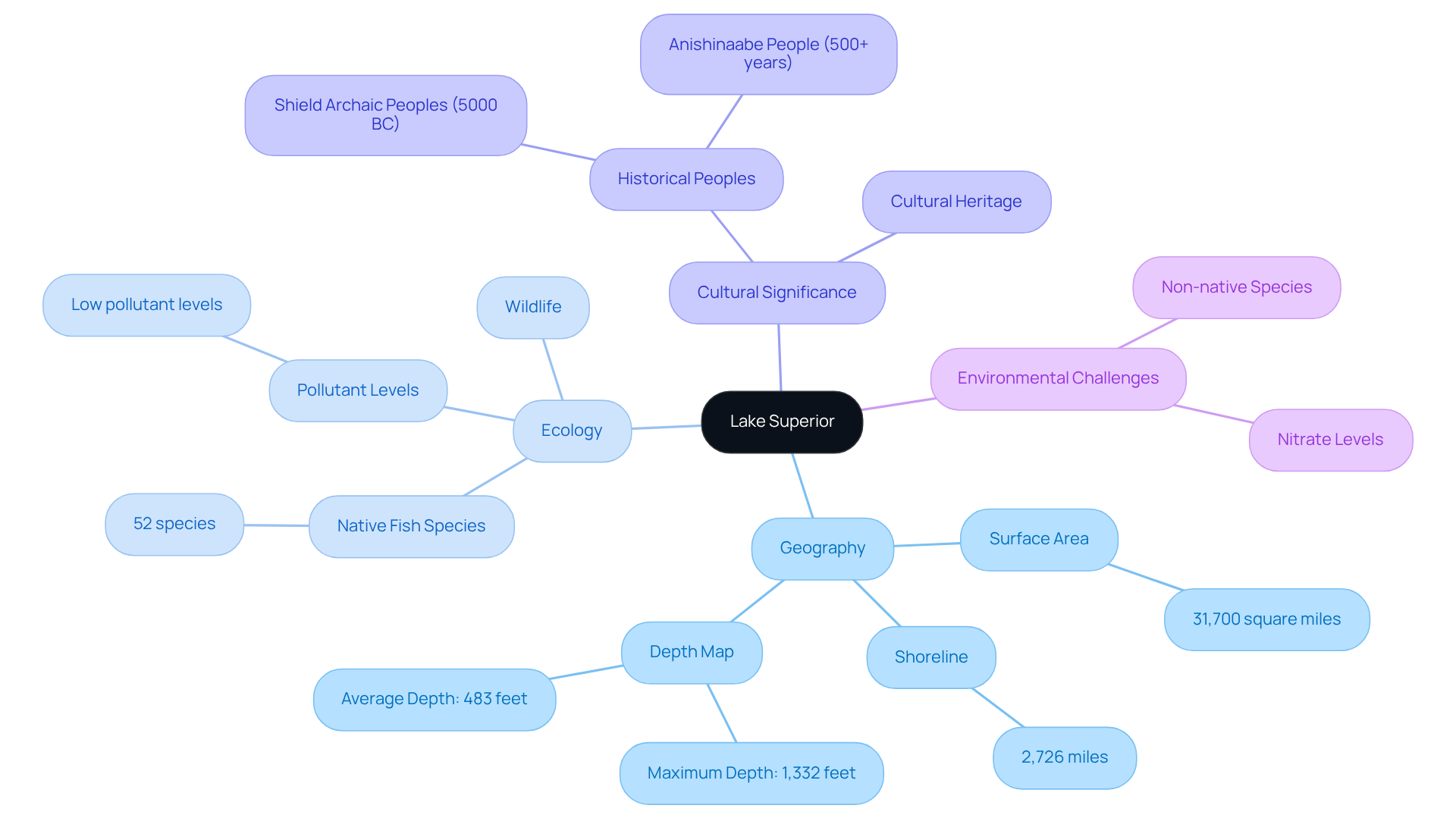
Lake Superior, the largest of the Great Lakes by surface area, spans over 31,700 square miles and is located on the border between the United States and Canada. Renowned for its stunning natural beauty, diverse ecosystems, and rich cultural history, this lake serves as a vital resource for local communities and a significant habitat for 52 native fish species—the fewest of any Great Lake—along with various wildlife.
Understanding its geography is crucial for appreciating the lake superior depth map, which illustrates the intricate underwater landscape and highlights the lake's distinctive features, including its many islands and deep basins. Each elevation map from Pangea Maps is a handcrafted 3D portrayal, meticulously drawn over bathymetry, designed to convey your unique narrative.
The shoreline and islands of this vast freshwater lake extend 2,726 miles, underscoring its enormity. This knowledge is essential for anyone seeking to utilize the lake superior depth map for navigation, research, or as a personalized gift that reflects a connection to this remarkable body of water.
Recent studies highlight ongoing ecological challenges faced by this large freshwater body, including rising nitrate levels and the encroachment of non-native species, which threaten its biodiversity. However, the lake maintains relatively low pollutant levels, primarily due to airborne transport, positively contributing to its ecological health.
Furthermore, Lake Superior boasts a retention time of 191 years, a critical factor when discussing its water quality. The historical context of the region is equally significant, with the Shield Archaic peoples arriving around 5000 BC and the Anishinaabe people inhabiting the area for over 500 years, enriching the cultural heritage of Lake Superior.
Pangea Maps' handcrafted 3D creations celebrate these stories and memories, using premium, environmentally sourced materials to create lasting keepsakes that honor the beauty and significance of this iconic lake.

Understand the Depth Map: Creation and Data Representation
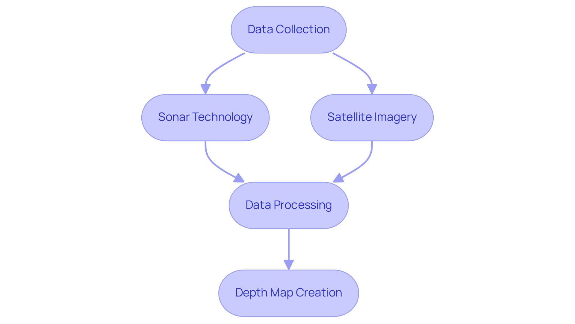
Depth maps are expertly crafted using a combination of sonar technology and satellite imagery, which allows for precise measurements of underwater topography. This sophisticated process entails the collection of data that is meticulously processed to visually represent various depths, often utilizing color gradients to indicate different depth levels.
For Lake Superior, this method effectively captures its deepest points, underwater ridges, and other notable features, creating a lake superior depth map that offers a comprehensive view of the lake's unique characteristics. Understanding the creation of these charts not only enhances the ability to read and interpret them but also elevates their value as personalized gifts, reflecting the recipient's connection to the lake's distinctive traits.
The integration of advanced satellite imagery ensures high precision in mapping, with studies indicating a prediction accuracy ratio ranging from 82% to 94%. This remarkable level of precision, coupled with the aesthetic appeal of the maps, positions them as a meaningful choice for commemorating special locations.

Utilize the Depth Map: Applications in Navigation and Research
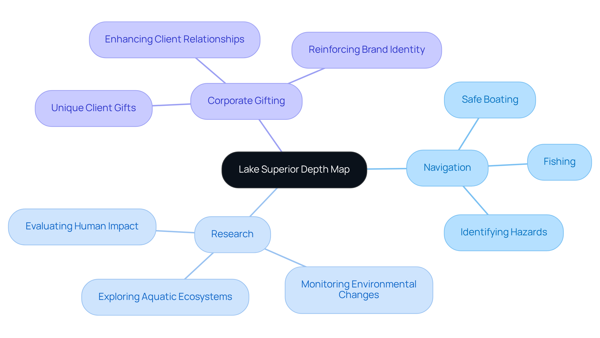
The lake superior depth map stands out as an invaluable asset across various applications, particularly in navigation and research. For navigators, grasping the lake superior depth map is vital for ensuring safe boating and fishing. The lake superior depth map plays a crucial role in identifying shallow regions and submerged hazards, significantly reducing the likelihood of incidents.
In the realm of research, sonar images serve as essential tools for exploring aquatic ecosystems, monitoring environmental changes, and evaluating the effects of human activities on the health of the lake, with particular emphasis on the lake superior depth map.
Furthermore, businesses can leverage these charts in corporate gifting, offering clients a distinctive and functional item that symbolizes their connection to the region. This approach not only enhances client relationships but also reinforces brand identity, making these maps an essential component of any corporate gifting strategy.

Analyze Environmental Impact: Depth and Ecosystem Interactions
The size of Lake Superior significantly shapes its ecosystems, influencing water temperature, light penetration, and nutrient distribution—elements critical for supporting diverse aquatic life. Understanding these interactions is vital for conservation efforts, as it helps identify areas vulnerable to environmental changes. The lake superior depth map serves as a valuable resource for researchers and environmentalists, offering insights into how variations in depth affect the health of the lake.
Furthermore, businesses can leverage this information in their corporate gifting strategies by offering Pangea Maps' artisanal handcrafted 3D maps. These custom designs feature hand sketches over bathymetry, promoting sustainability and environmental stewardship while celebrating cherished locations and memories. They make thoughtful, educational gifts that resonate emotionally with recipients, encouraging inquiries and orders for those looking to provide unique, personalized gifts.
Conclusion
The Lake Superior depth map is not just a representation of underwater topography; it is a vital tool that reveals the lake's geographical intricacies and its crucial role in navigation, research, and environmental conservation. This map allows us to appreciate the underwater landscape of Lake Superior, providing valuable insights into its unique features and ecological health.
Key arguments presented throughout this exploration underscore the lake's impressive size, diverse ecosystems, and the advanced technology employed to create precise depth maps. The applications of these maps extend far beyond navigation; they enhance research capabilities and can even serve as meaningful corporate gifts, fostering connections to this iconic body of water.
Ultimately, engaging with the Lake Superior depth map opens a gateway to understanding the delicate balance of its ecosystems and the ongoing environmental challenges the lake faces. This information not only encourages a deeper appreciation for Lake Superior but also prompts action towards its conservation, highlighting the importance of sustainable practices in preserving such a vital natural resource. We invite you to explore the craftsmanship and personalization options available, ensuring that every interaction with this map captures your unique story and fosters a lasting connection to Lake Superior.
Frequently Asked Questions
What is Lake Superior and where is it located?
Lake Superior is the largest of the Great Lakes by surface area, spanning over 31,700 square miles. It is located on the border between the United States and Canada.
What are some key features of Lake Superior?
Lake Superior is renowned for its stunning natural beauty, diverse ecosystems, and rich cultural history. It serves as a vital resource for local communities and is a significant habitat for 52 native fish species, which is the fewest of any Great Lake.
Why is understanding Lake Superior's geography important?
Understanding Lake Superior's geography is crucial for appreciating its depth map, which illustrates the intricate underwater landscape, including its many islands and deep basins. This knowledge is essential for navigation, research, and creating personalized gifts related to the lake.
What is the length of Lake Superior's shoreline?
The shoreline and islands of Lake Superior extend 2,726 miles, highlighting its vastness.
What ecological challenges does Lake Superior face?
Lake Superior faces ongoing ecological challenges such as rising nitrate levels and the encroachment of non-native species, which threaten its biodiversity. However, it maintains relatively low pollutant levels, primarily due to airborne transport.
What is the retention time of Lake Superior and why is it significant?
Lake Superior has a retention time of 191 years, which is a critical factor when discussing its water quality.
What is the historical significance of the Lake Superior region?
The historical context of the region includes the arrival of the Shield Archaic peoples around 5000 BC and the Anishinaabe people who have inhabited the area for over 500 years, enriching the cultural heritage of Lake Superior.
How does Pangea Maps contribute to the appreciation of Lake Superior?
Pangea Maps creates handcrafted 3D maps that celebrate the stories and memories associated with Lake Superior, using premium, environmentally sourced materials to create lasting keepsakes that honor the lake's beauty and significance.


