Overview
The article titled "Boater Map: Understanding Its Importance, Origin, and Features" underscores the critical role of boater maps in maritime navigation. These maps are indispensable tools for safe navigation, delivering essential information about waterways, hazards, and navigational aids. This information is vital for both recreational and commercial boaters. The article emphasizes that the historical evolution and modern features of these maps significantly enhance their usability and safety in today's boating activities.
Introduction
Navigating the vast waterways is an experience that can be both exhilarating and daunting. The difference between a smooth journey and a perilous mishap often hinges on the tools at a sailor's disposal. Boater maps, or nautical charts, are not mere illustrations; they are essential lifelines that provide critical information about depths, hazards, and navigational aids.
As technology advances, the evolution of these maps raises an intriguing question: how can boaters harness the latest innovations to enhance their safety and enjoyment on the water? This inquiry invites you to explore the craftsmanship and personalization of these vital tools, designed to capture your unique story on the water.
Define Boater Map: A Comprehensive Overview
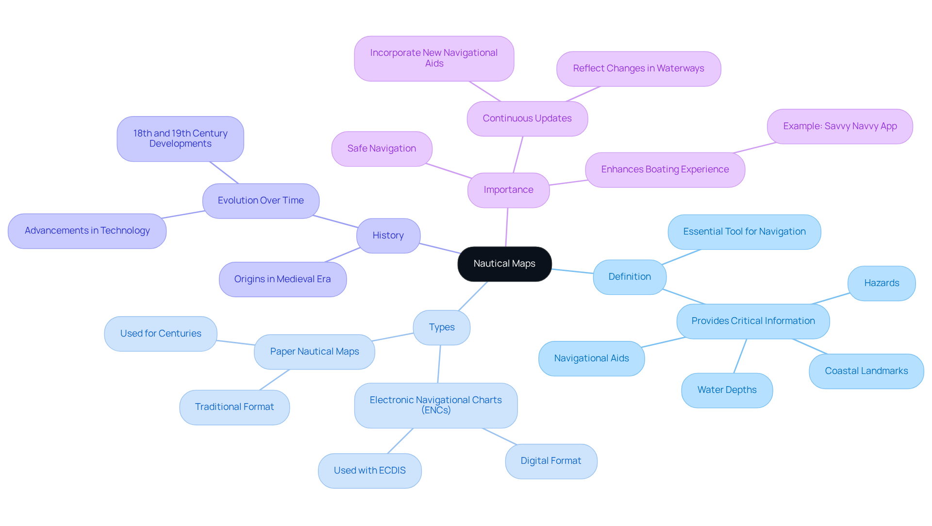
A navigation map, commonly known as a nautical map, is an essential tool meticulously designed to aid sailors in navigating waterways with precision and safety. These charts provide critical information, including water depths, navigational aids, hazards, and coastal landmarks. Unlike conventional maps, nautical charts are specifically tailored for marine navigation, employing unique symbols and scales vital for safe boating. They serve as indispensable resources for both recreational and commercial boaters by offering a boater map that empowers them to navigate waterways with confidence and efficiency.
Historically, maritime maps trace their origins to the medieval era, undergoing significant evolution over time. Today, two primary varieties of nautical maps exist:
- Electronic Navigational Charts (ENCs)
- Paper Nautical Maps
ENCs are digital, utilized with electronic display and information systems, while Paper Nautical Maps have been the traditional choice for mariners for centuries. Furthermore, nautical maps are continuously updated to reflect changes in waterways, ensuring their reliability and safety.
For instance, Luke Fraser, a Maine angler, utilizes the Savvy Navvy app and the boater map to optimize his time on the water, demonstrating how modern nautical charts enhance the boating experience. This evolution in nautical mapping not only reflects advancements in technology but also underscores the importance of reliable navigation tools in today's maritime activities.
Contextualize Importance: Navigating Safely with Boater Maps
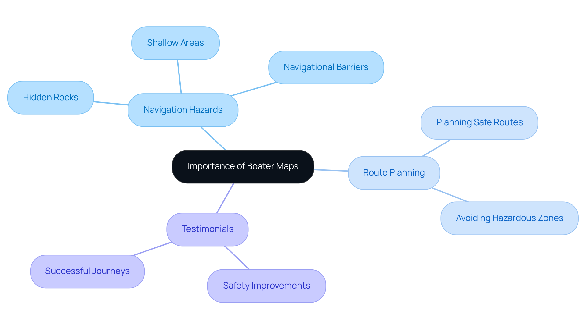
Mariner charts stand as indispensable instruments for secure navigation, offering comprehensive information that empowers seafarers to evade dangers such as hidden rocks, shallow areas, and navigational barriers. These charts deliver vital details regarding the positions of buoys, lights, and other navigation tools, essential for maintaining a secure route.
By utilizing navigation charts, skippers can meticulously plan their routes, ensuring navigation within safe channels while steering clear of hazardous zones. The significance of these boater maps is reinforced by testimonials from seasoned boaters who affirm that the boater map is effective in preventing accidents and enhancing overall boating safety.
Numerous individuals have recounted how strategic route planning with maritime maps has led to successful journeys, free from incidents. As Simon Jollands aptly states, "Nautical maps are therefore a crucial tool for any sailor to navigate safely and effectively."
Ultimately, the use of a boater map is paramount in promoting safe boating practices and ensuring a smooth, enjoyable experience on the water.
Trace the Origin: The Evolution of Boater Maps
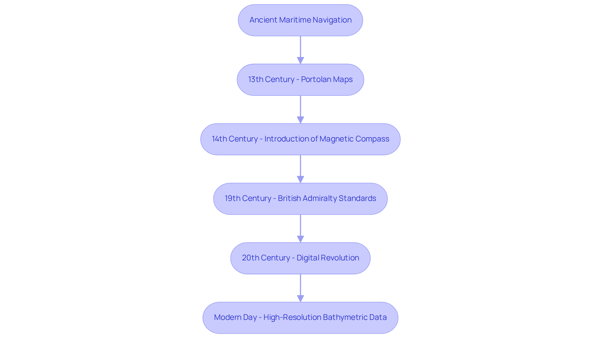
The evolution of boater maps is rooted in ancient maritime navigation, where early sailors depended on rudimentary diagrams and celestial navigation techniques. The earliest documented nautical maps, known as 'Portolan' maps, emerged in the 13th century, primarily in the Mediterranean. These maps utilized compass lines, although they lacked precise distance representation. A pivotal moment occurred in the 14th century with the introduction of the magnetic compass, which enabled more accurate mapping of waterways. As cartography advanced, the 19th century saw the British Admiralty establish contemporary mapping standards, setting a benchmark for nautical maps that incorporated survey-based representations, depth soundings, and navigational aids.
The 20th century ushered in a digital revolution that transformed the creation of nautical charts, leading to the development of electronic navigational charts (ENCs) and chart plotters. These modern tools are continuously updated with real-time information derived from GPS and satellite imagery, enhancing the precision and reliability of navigation. Capt. Matthew Meskun, chief of prevention with the Coast Guard Fifth District, emphasized this importance, stating, "information in the modernized LNM will be updated on a daily basis, Monday through Friday, at a minimum," highlighting the critical role of real-time data in navigation.
Today, boater maps are designed to be accessible and user-friendly for boaters of all skill levels. The integration of sonar technology and satellite-based radar has yielded high-resolution bathymetric data, significantly improving the accuracy of nautical charts. This ongoing evolution underscores the essential need for reliable navigation tools in an ever-changing marine environment, ensuring safer and more efficient maritime travel.
Identify Key Characteristics: Features of Effective Boater Maps
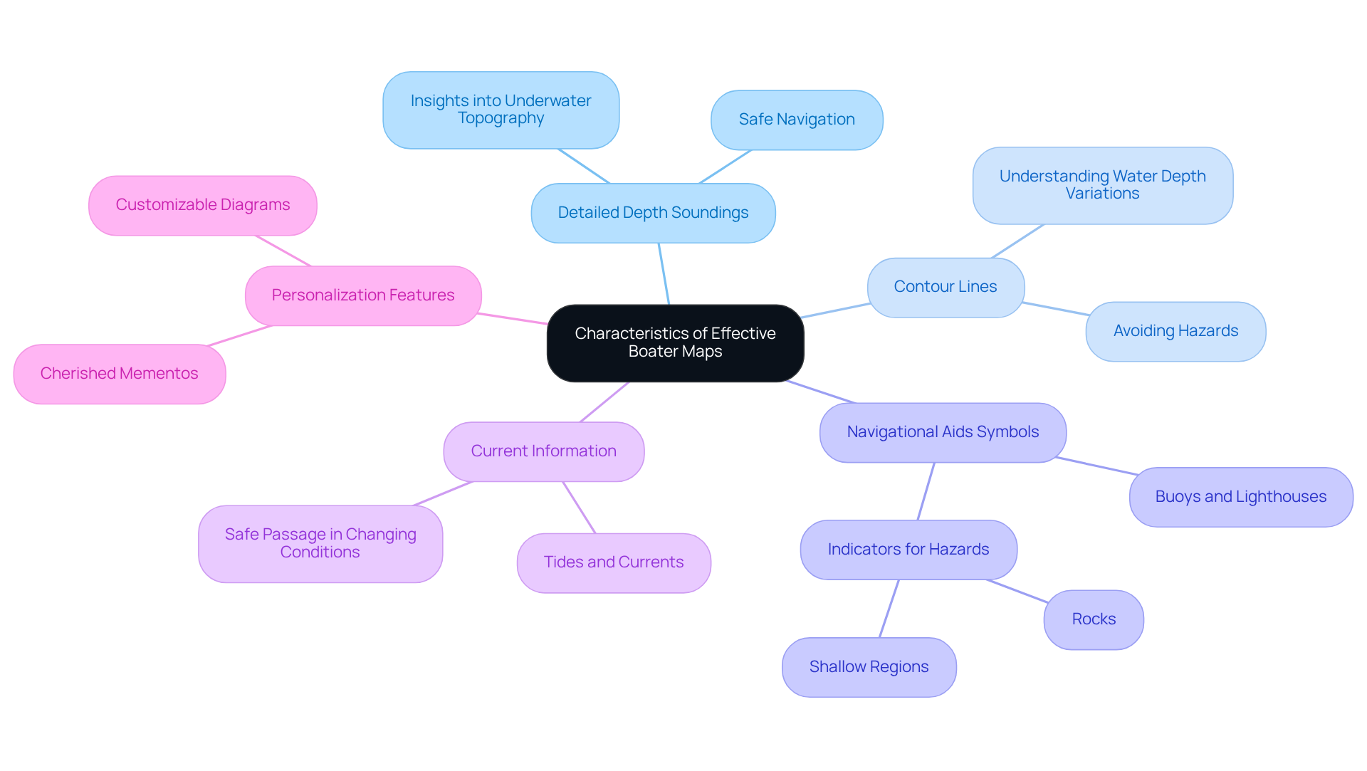
Effective navigational charts, such as a boater map, are distinguished by several critical characteristics that significantly enhance their usability.
- Detailed depth soundings are essential, as they provide insights into underwater topography, allowing mariners to navigate safely.
- Contour lines further aid in understanding variations in water depth, which is vital for avoiding hazards.
- Furthermore, these charts include distinct symbols for navigational aids, such as buoys and lighthouses, along with indicators for potential hazards like rocks and shallow regions.
- Current information on tides and currents is also essential, ensuring safe passage in changing conditions.
Contemporary navigation charts frequently provide a boater map with adjustable features, empowering users to design personalized diagrams that represent their preferred waterways. This feature transforms useful tools into significant gifts, enabling watercraft enthusiasts to honor their beloved places while enhancing their journey experience. By merging functionality with personalization, these charts serve not only as navigational tools but also as cherished mementos, handcrafted with care to capture your unique story.
Explore Current Applications: Boater Maps in Modern Navigation
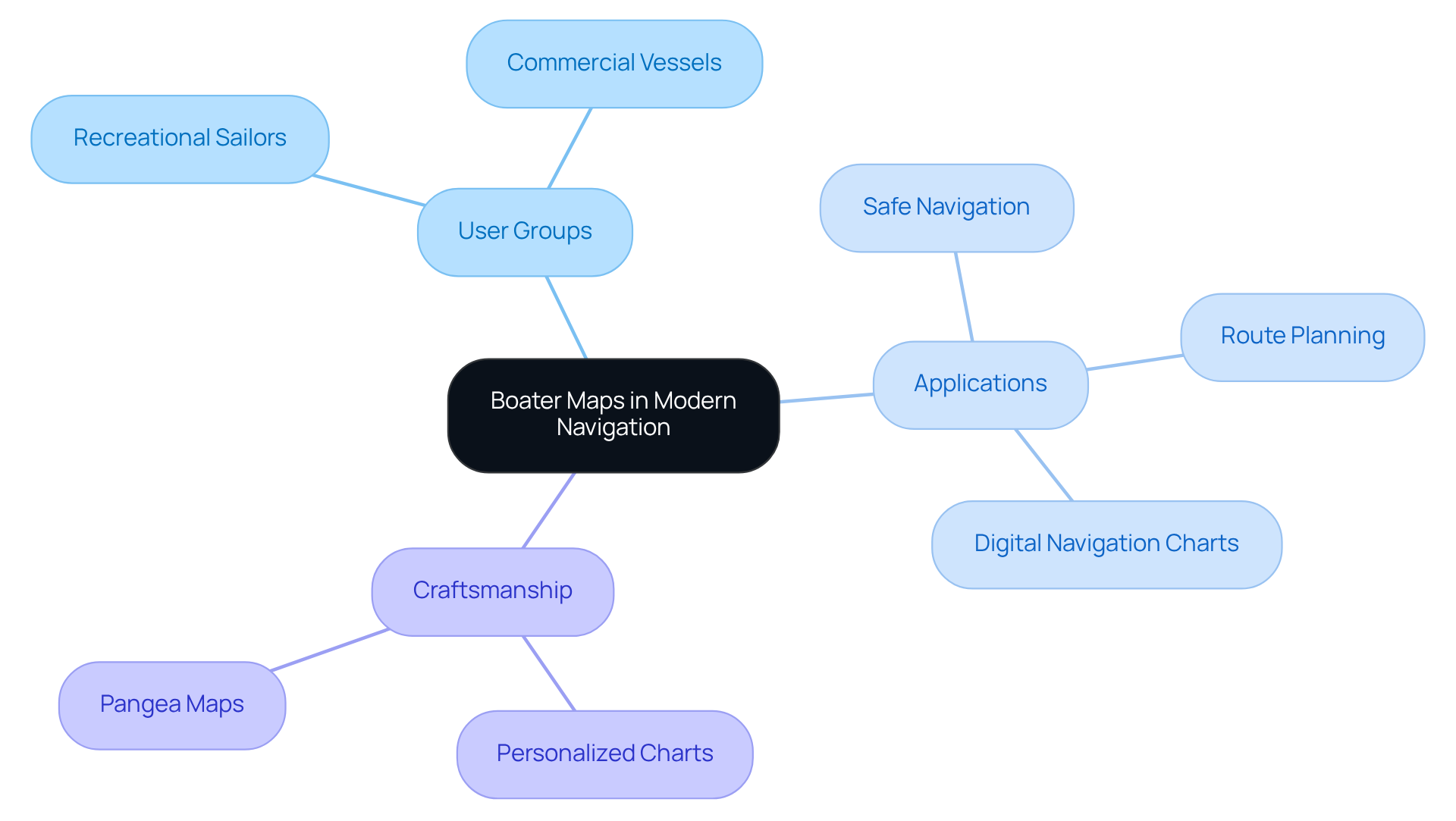
In contemporary sailing, nautical charts play a pivotal role for a diverse group of individuals, ranging from leisure sailors to freight shipping firms. Recreational sailors rely on these charts for safe navigation during their leisure pursuits, while commercial vessels utilize them for meticulous route planning and compliance with maritime regulations. Moreover, many boating applications now feature digital navigation charts, providing real-time updates on conditions and potential hazards.
The marine sector recognizes the value of personalized navigational charts as corporate gifts, particularly those crafted by Pangea Maps. These artisanal, handcrafted 3D representations showcase distinctive hand drawings over bathymetry graphs. Each custom design, taking approximately an hour to create and hand-glued and framed locally, not only celebrates a passion for boating but also serves as a meaningful gift that tells a unique story.
This versatility underscores the ongoing significance of the boater map in enhancing the overall boating experience. For those interested in making a lasting impression, consider exploring the exceptional options available and inquire about creating a personalized navigational chart that captures your unique journey.
Conclusion
Navigating waterways safely and efficiently relies heavily on the utilization of boater maps, or nautical charts, which serve as indispensable tools for sailors. These maps provide crucial information about water depths, navigational aids, and hazards, ensuring that both recreational and commercial boaters can traverse maritime environments with confidence. The evolution of these maps, from ancient Portolan charts to modern electronic navigational charts, highlights their enduring significance in the maritime world.
Key insights into the importance of boater maps reveal their role in preventing accidents and enhancing safety on the water. By allowing skippers to plan routes meticulously, these charts help avoid dangers such as shallow areas and hidden rocks. The integration of real-time data and user-friendly features further enhances their effectiveness, making them accessible to boaters of all skill levels. As demonstrated by testimonials from seasoned mariners, the strategic use of boater maps can lead to successful, incident-free journeys.
In light of the ongoing advancements in navigational technology and the unique characteristics of effective boater maps, it is evident that these tools are crucial for promoting safe boating practices. Whether one is a leisure sailor or a commercial operator, the right navigational chart can transform the boating experience. Embracing the use of personalized and up-to-date boater maps not only ensures safer navigation but also fosters a deeper connection to the waterways, inviting all mariners to explore their unique stories on the water.
Frequently Asked Questions
What is a boater map?
A boater map, also known as a nautical map, is a navigation tool specifically designed to assist sailors in safely navigating waterways. It provides critical information such as water depths, navigational aids, hazards, and coastal landmarks.
What are the two primary types of nautical maps?
The two primary types of nautical maps are Electronic Navigational Charts (ENCs), which are digital and used with electronic display systems, and Paper Nautical Maps, which have been the traditional choice for mariners for centuries.
How do nautical maps differ from conventional maps?
Nautical maps are tailored specifically for marine navigation, employing unique symbols and scales that are vital for safe boating, unlike conventional maps which do not focus on maritime navigation.
Why are nautical maps continuously updated?
Nautical maps are continuously updated to reflect changes in waterways, ensuring their reliability and safety for mariners.
How do boater maps enhance the boating experience?
Boater maps enhance the boating experience by allowing mariners to plan their routes effectively, navigate safely, and avoid hazards, thus promoting overall boating safety.
What testimonials support the use of boater maps?
Testimonials from seasoned boaters affirm that boater maps are effective in preventing accidents and enhancing overall boating safety, with many recounting successful journeys planned using these maps.
What is the importance of using a boater map?
The use of a boater map is crucial for promoting safe boating practices, allowing skippers to navigate within safe channels and avoid hazardous areas, ultimately ensuring a smooth and enjoyable experience on the water.


