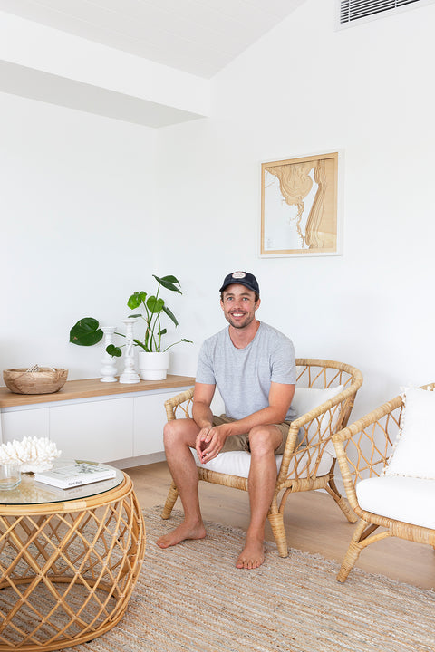
Founder/Designer
Tom Percy is an Industrial Designer with nearly a decade of experience. Whilst working full-time he developed and refined his vision of 3D ocean maps as a personal side project. His passion for the water extends beyond art into windsurfing, skiing and sailing, as well as protecting our coastlines.
The first map created was of Moreton Bay in Australia, home to Tom and his partner Bernadette. It was a present for his father’s birthday and was received with great enthusiasm. Since then he has produced maps of countless coastlines. With custom requests for locations from all around the globe, Pangea Maps continues to grow.
Our process & Materials
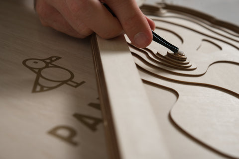
The scale and composition of each map is carefully considered. Once a region has been identified the bathymetric data is sourced and the contours are sketched. This is a meticulous process combining modern surveying techniques and CAD technology with the art of cartography.
The contoured layers are then laser-cut out of plywood sheets. The natural grain of the sustainably sourced wood provides unique features to every piece. Each layer represents between 1-5m of water depth (depending on the region). To form the 3D map the layers are methodically hand-glued together and this is the most time-consuming step which can take 5 hours per map.
Laser cut white acrylic forms the top layer, representing the land, with the intention to keep things simple and focus the eye on the ocean and its intricacies.
A natural hardwood white frame with protective plexiglass finishes the map and it is ready to hang. There is the option to have a beautiful handmade wooden box added to your order, making it the perfect gift.
About Pangea
Pangea Maps was born out of a love for the water. The vastness and beauty below the water’s surface is what we wanted to capture. Using bathymetric data our 3D maps depict the contours of the ocean floor and reveal those treasured spots where we can surf, dive, swim, sail and play.
“Pangea” was the first supercontinent which, over 300 million years, broke up into the 7 continents we know today. It is the coastlines of these continents that form our saltwater playground and inspire what we do.
We are passionate about protecting the world’s oceans and coastlines. We hope that our maps can help people to connect with their environment by appreciating it from a whole new perspective.