Overview
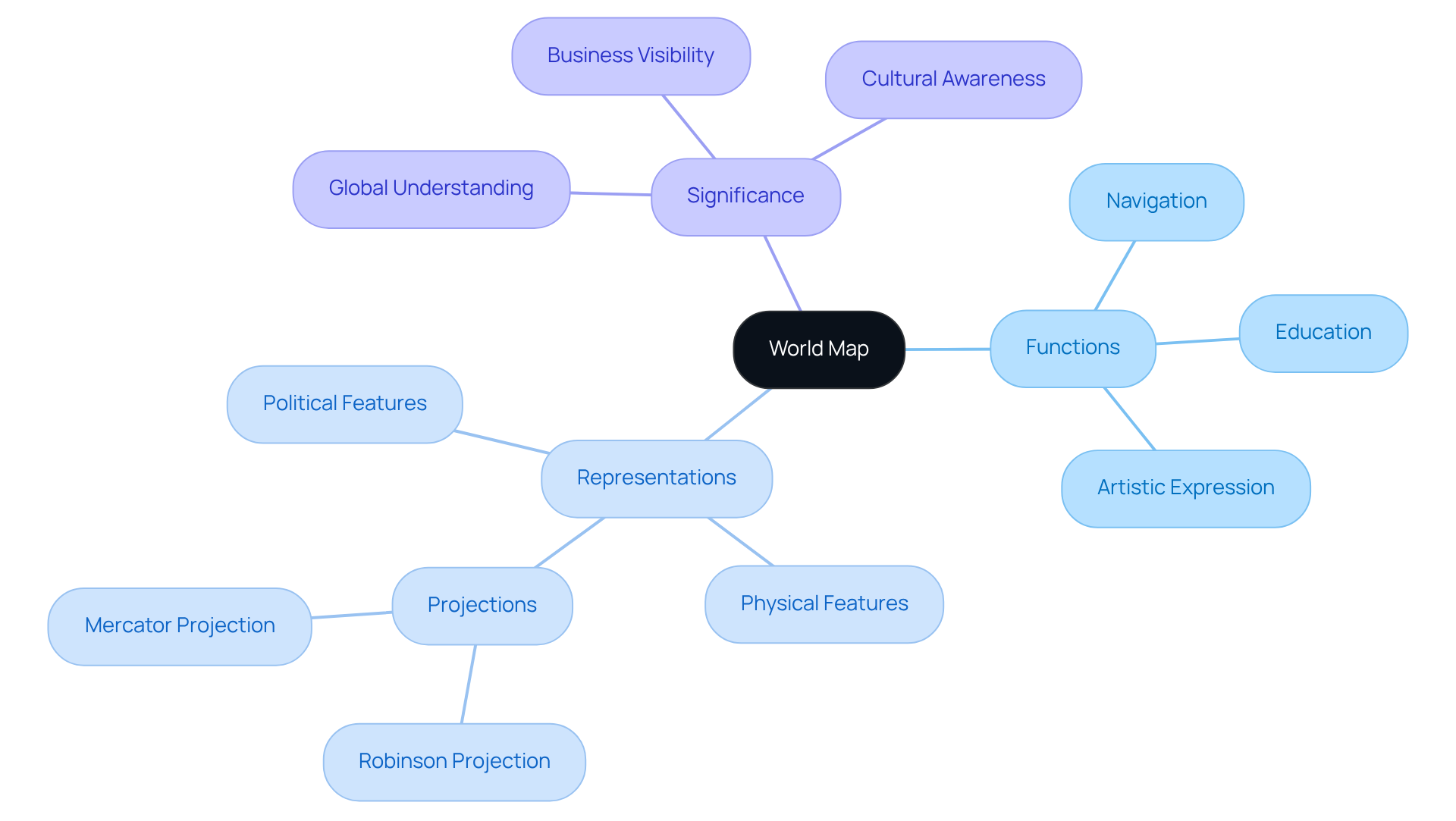
A world map serves as a powerful graphical representation of the Earth's surface, illustrating both political and physical features that enhance our understanding of global geography and spatial relationships. Its significance extends beyond mere representation; it plays a crucial role in navigation, education, and cultural representation. Furthermore, the design elements—such as projections and symbols—are not only functional but also enhance the aesthetic appeal of the map, making it a vital tool for both learning and exploration.
Introduction
A world map transcends mere visual representation of the Earth's surface; it serves as a gateway to understanding the intricate relationships that define our planet. These maps play crucial roles in education, navigation, and business strategy, offering insights into geographical features, political boundaries, and cultural contexts. Yet, the art of map-making is fraught with challenges, particularly the distortions that occur when translating a spherical world onto a flat surface.
- How do these distortions influence our perception of geography?
- What innovations in design have emerged to enhance our understanding of the world?
This exploration is not just academic; it invites inquiries into the craftsmanship and personalization of maps, crafted with care to capture unique stories and perspectives.
Define World Map: A Comprehensive Overview
A world map serves as a powerful graphical representation of the Earth's surface, illustrating both political and physical features, including continents, countries, oceans, and notable geographical landmarks. These maps vary in scale and detail, fulfilling diverse functions such as navigation, education, and artistic expression. They are essential for comprehending global geography and spatial relationships, allowing individuals to envision the planet in a simplified manner.
The design of a world map often employs different representations to accurately portray the spherical Earth on a two-dimensional world map surface. This intricate process can introduce distortions in size, shape, and distance, which are critical considerations in map-making. For instance, the Robinson projection is favored for its balanced depiction of landmasses, making it a popular choice in educational contexts and corporate gifting.
Statistics reveal that over 200 million businesses and locations are listed on Google Maps, underscoring the significance of accurate geographical representation in enhancing visibility and accessibility for businesses. Moreover, expert insights emphasize that the world map is not merely an instrument for navigation; it also acts as an artistic representation that ignites creativity and inspires discovery. In educational settings, they play an essential role in teaching geography, aiding students in grasping complex spatial concepts and fostering a deeper awareness of their surroundings.

Trace the Evolution: Historical Context of World Maps
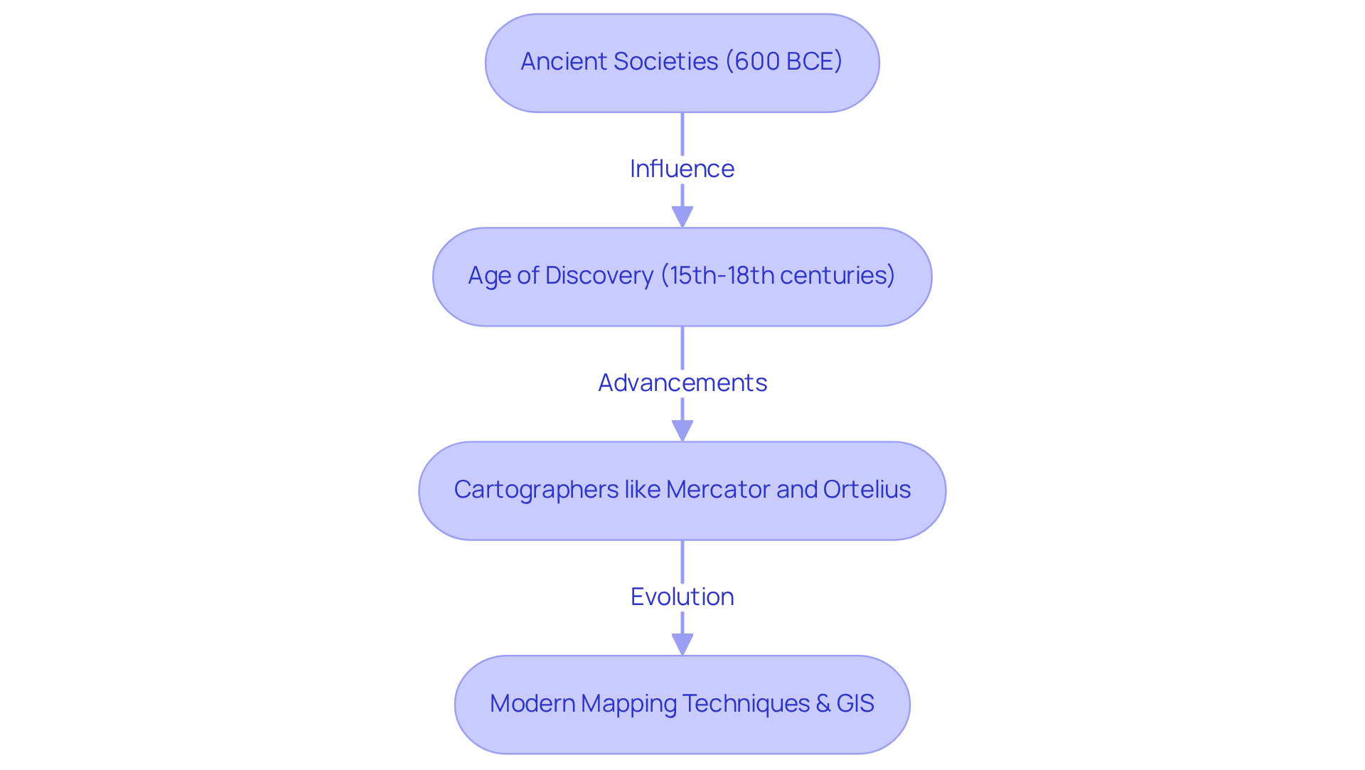
The development of the woeld map is a remarkable journey that traces its origins to ancient societies, with the oldest recognized instances emerging from Babylon around 600 BCE. These early maps, though simplistic, laid the foundation for our understanding of geography, often depicting the world as flat and focusing on local landscapes.
As exploration flourished during the Age of Discovery from the 15th to the 18th centuries, cartographers began to create more precise representations of the woeld map, incorporating new findings and advancements in navigation. Notable figures such as Gerardus Mercator and Abraham Ortelius played pivotal roles in refining modern map-making techniques.
The introduction of various map representations, such as the innovative Mercator technique, enhanced the depiction of the Earth's surface, despite the inherent distortions these methods introduced. Today, the woeld map continues to evolve alongside technological advancements, embracing digital plotting and Geographic Information Systems (GIS).
This ongoing development underscores the craftsmanship and personalization that define modern mapping, inviting inquiries and engagement from those interested in exploring the world through these sophisticated tools.

Examine Design Elements: Key Characteristics of World Maps
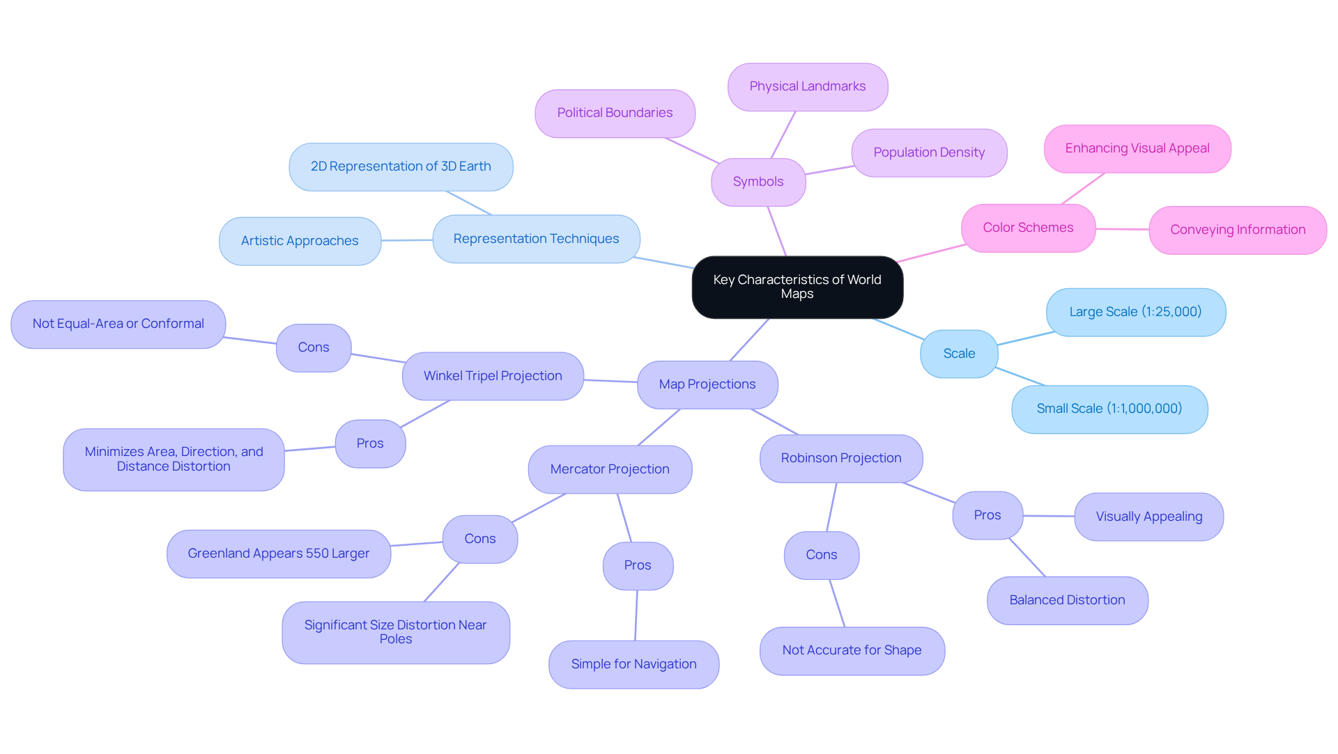
World maps possess distinctive features that are essential for understanding their significance, including scale, representation, symbols, and color schemes. The scale of the world map determines the level of detail and the area depicted, while the mapping technique influences how the three-dimensional Earth is represented on the two-dimensional surface of the world map. Notable representations on the world map include the Robinson, introduced in 1963, Mercator, and Winkel Tripel, each presenting unique benefits and drawbacks related to distortion. For example, the Mercator world map significantly distorts country sizes, particularly near the poles, making Greenland appear 550% larger than its actual size—an important consideration for grasping geographical relationships. Conversely, the Robinson world map provides a more visually appealing representation by balancing area and shape distortions, while the Winkel Tripel design minimizes distortions in area, direction, and distance, resulting in a more accurate depiction of the globe. Arthur Robinson, the mastermind behind the Robinson design, noted that he approached map-making with an artistic vision, focusing on the most aesthetically pleasing shapes and sizes before developing the mathematical formula to achieve that effect.
Symbols on a world map serve to represent various features, including political boundaries, physical landmarks, and population density, while color schemes effectively convey information about diverse regions, climates, or cultural aspects. The U.S. Geological Survey utilizes over 18 different world map projections for various applications, underscoring the necessity of selecting appropriate projections tailored to specific needs. Effective world map design strikes a balance between aesthetic appeal and clarity, ensuring that the world map fulfills its intended purpose while remaining visually engaging. Elements such as legends, titles, and scale bars are critical for providing context and enhancing usability on a world map. Current trends in cartographic design highlight the significance of these features, ensuring that the world map not only serves its intended function but also captivates viewers visually.

Explore Significance: The Role of World Maps Today
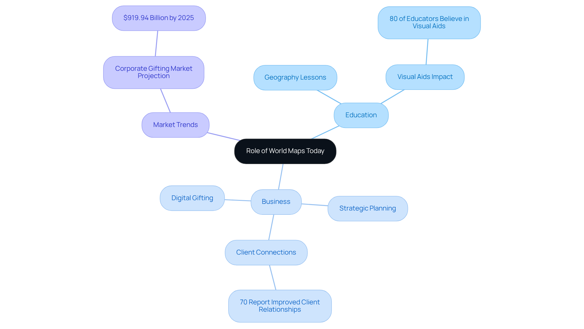
Global representations serve as essential instruments in education, navigation, and cultural portrayal. In educational environments, they facilitate geography lessons, enabling students to effectively grasp spatial relationships and global issues. A study reveals that 80% of educators believe visual aids, such as charts, significantly enhance learning outcomes.
In the business sector, geographic representations are utilized for strategic planning, market analysis, and as distinctive gifts that resonate with clients and employees. Customized charts from Pangea Maps, showcasing important milestones or collective experiences, can strengthen business relationships, with 70% of companies reporting improved client connections through thoughtful gifting. Each map is handcrafted over bathymetry, illustrating the water's topography, and is custom-designed to narrate a unique story, taking approximately an hour to create.
The corporate gifting market is projected to reach $919.94 billion by 2025, underscoring the importance of personalized gifts in today's business landscape. The rise of digital formats has further increased the utility of global charts, enabling interactive exploration and data visualization. This capability assists organizations in making informed decisions based on geographical data, including climate change impacts, population trends, and resource distribution.
Additionally, 60% of businesses anticipate that digital gifting platforms will replace traditional ordering methods, highlighting the shift towards digital solutions in corporate gifting. Consequently, world maps are invaluable resources that cultivate a deeper understanding and appreciation of our interconnected world.

Conclusion
A world map is not merely a simple representation of geography; it embodies a complex interplay of design, history, and functionality that significantly enhances our understanding of the Earth. By illustrating both political and physical features, these maps serve as vital tools for navigation, education, and cultural expression, allowing individuals to visualize and engage with the world around them.
The evolution of world maps has been traced from their ancient origins to modern technological advancements. Key insights highlight the importance of various mapping techniques, such as the Robinson and Mercator projections, which balance aesthetic appeal with accuracy. Furthermore, the role of world maps in education and business underscores their significance in fostering spatial awareness and facilitating strategic decision-making.
In an increasingly interconnected world, the value of world maps extends beyond mere navigation. They are essential instruments that promote understanding and appreciation of global dynamics. Engaging with world maps encourages exploration, creativity, and informed decision-making, making them invaluable resources in both personal and professional contexts. Embracing this knowledge can inspire individuals and organizations alike to deepen their geographical literacy and enhance their global perspective.
Frequently Asked Questions
What is a world map?
A world map is a graphical representation of the Earth's surface that illustrates political and physical features, including continents, countries, oceans, and notable geographical landmarks.
What are the main functions of a world map?
World maps serve various functions such as navigation, education, and artistic expression, helping individuals comprehend global geography and spatial relationships.
How does a world map represent the spherical Earth?
The design of a world map often employs different representations to portray the spherical Earth on a two-dimensional surface, which can introduce distortions in size, shape, and distance.
What is the Robinson projection?
The Robinson projection is a type of map projection favored for its balanced depiction of landmasses, making it popular in educational contexts and for corporate gifting.
How significant is the use of maps in business?
Over 200 million businesses and locations are listed on Google Maps, highlighting the importance of accurate geographical representation for enhancing visibility and accessibility for businesses.
Besides navigation, what other roles does a world map play?
A world map acts as an artistic representation that inspires creativity and discovery, and it plays a crucial role in education by helping students understand complex spatial concepts and fostering awareness of their surroundings.


