Overview
A boat chart, commonly referred to as a nautical map, serves as a specialized navigation tool that delivers crucial information about waterways. This includes depth soundings, shoreline configurations, and navigational hazards. The significance of these charts cannot be overstated; they are essential for ensuring safe maritime navigation.
By detailing their unique features and historical evolution, we underscore how these elements collectively empower mariners to plan safe routes and avert potential accidents.
Introduction
Navigating the vast and unpredictable waters presents a formidable challenge for mariners, underscoring the necessity for specialized tools that ensure safe passage. Boat charts, or nautical maps, are indispensable navigational aids that provide detailed insights into marine environments, encompassing depths, hazards, and navigational markers. Yet, with the rapid evolution of technology and the increasing complexity of modern waterways, how can sailors effectively utilize these charts to avert maritime accidents? This article explores the features, history, and critical importance of boat charts, shedding light on their essential role in enhancing navigational safety on the high seas.
Define Boat Chart: A Key Navigation Tool
A boat chart, commonly known as a nautical map, is a specialized representation designed to assist mariners in navigating waterways with precision and safety. These maps provide intricate information about marine ecosystems, including liquid measurements, shoreline shapes, and the positions of navigational markers like buoys and lighthouses. Unlike typical maps, marine guides and boat charts are specifically crafted for maritime navigation, utilizing unique symbols and scales that address the complexities of navigating water bodies.
Key aspects of nautical maps include:
- Depth soundings, which reveal the underwater topography.
- Contour lines that assist mariners in visualizing the seabed's shape.
- Highlighting potential hazards such as rocks, wrecks, and shallow areas, enabling sailors to plan safe routes effectively.
The significance of these boat charts cannot be overstated; they are vital for voyage preparation, recognizing safe routes, and evading navigational hazards. Statistics indicate that appropriate utilization of nautical maps significantly decreases the likelihood of maritime incidents, underscoring their essential function in ensuring secure navigation on the water.
Trace the History of Boat Charts: From Ancient Maps to Modern Navigation
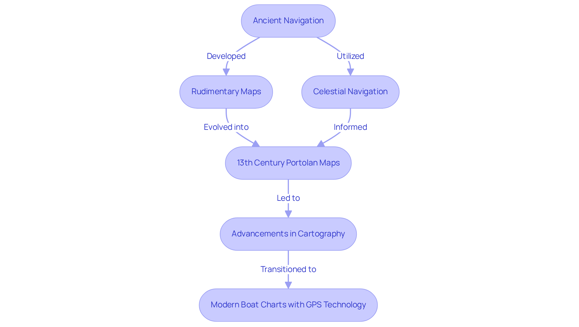
The history of maritime maps is a testament to human ingenuity, tracing back to ancient civilizations where early navigators relied on rudimentary maps and celestial navigation. The earliest recognized maritime maps, known as portolan maps, emerged in the Mediterranean during the 13th century. These intricate boat charts illustrated coastlines and navigational paths, empowering sailors to navigate with greater efficiency. As centuries progressed, advancements in cartography and navigation technology led to the development of increasingly precise and detailed maps. Today, the use of boat charts that incorporate electronic information and GPS technology significantly enhances navigational safety and efficiency for sailors around the globe.

Examine Key Features of Boat Charts: Symbols, Scales, and Depths
Nautical maps stand out due to their essential attributes, which include symbols, scales, and underwater markers. These symbols represent vital navigational aids—buoys, lighthouses, and underwater hazards—that are crucial for ensuring safe navigation. The scale of a diagram reveals the ratio of distances depicted to actual distances in the water, typically expressed as 1 inch equating to 20,000 inches in real-world terms. This scale is indispensable for mariners, enabling them to accurately measure routes and distances, thereby ensuring safe passages.
Depth indicators, displayed in feet or fathoms, provide critical insights into underwater topography, assisting navigators in avoiding shallow areas and submerged obstacles. For instance, a chart featuring the numeral 02 denotes a measurement of 2 feet, while a chart labeled with 55 signifies a measurement of 35 feet. These levels are represented by small figures indicating Mean Lower Low Water (MLLW), which is essential for understanding how these measurements are derived.
Grasping these underwater indicators is vital, as they can prevent maritime incidents by alerting boaters to potential dangers. Overall, a comprehensive understanding of these features is paramount for effective navigation and ensuring the safety of vessels at sea, particularly when using a boat chart.
Explore the Importance of Boat Charts in Safe Navigation
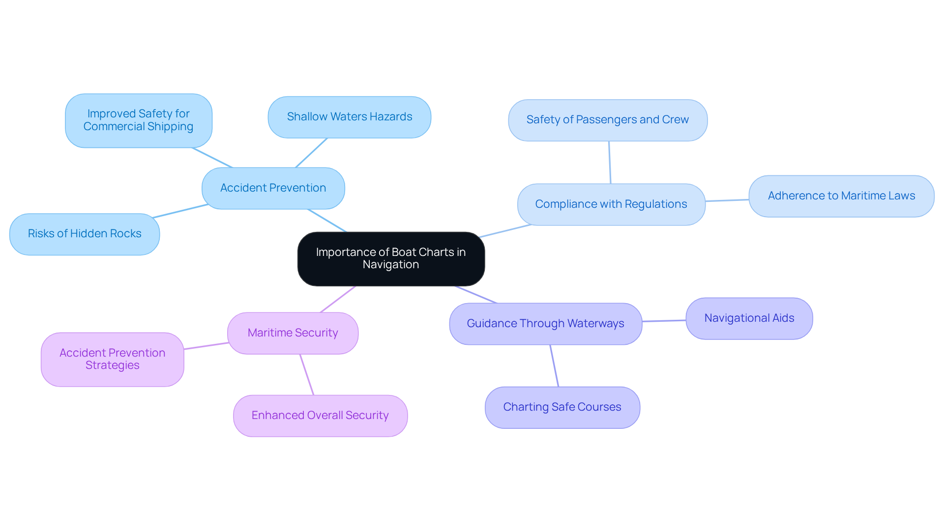
Vessel maps are indispensable tools for secure navigation on open seas, providing sailors with vital information regarding coastlines, depths, and potential hazards. These diagrams empower navigators to chart safe courses and avoid perilous areas, significantly reducing the risk of maritime incidents. Without precise navigational maps, vessels may encounter hidden rocks or shallow waters, leading to potentially catastrophic outcomes.
Furthermore, vessel maps are crucial for compliance with maritime regulations, ensuring the safety of both passengers and crew. They serve as a comprehensive guide for sailors, navigating them through complex waterways and enhancing overall maritime security.
Maritime protection organizations stress that the significance of accurate vessel maps cannot be overstated, as they are pivotal in accident prevention strategies. Real-world instances demonstrate how effective chart usage has improved safety for commercial shipping, illustrating that precise boat charts are essential for averting maritime accidents.

Conclusion
A boat chart is not just a tool; it is an essential navigation instrument crafted to guide mariners through waterways with precision and safety. These specialized nautical maps encapsulate critical information about marine topography, navigational markers, and potential hazards, underscoring their indispensable role in maritime navigation.
This article has explored key points regarding the features and historical evolution of boat charts. The discussion has covered the intricate symbols and scales that represent vital navigational aids, the significance of depth soundings, and the historical progression from ancient portolan maps to contemporary electronic charts. Each of these elements highlights the importance of boat charts in ensuring safe passage and adherence to maritime regulations.
Ultimately, the significance of boat charts transcends mere navigation; they are crucial in preventing maritime accidents and enhancing overall safety at sea. By understanding and effectively utilizing these navigational tools, sailors can significantly mitigate risks, navigate complex waterways with confidence, and contribute to a safer maritime environment. Emphasizing the necessity of accurate and detailed boat charts is paramount for anyone venturing onto the water, as they form the backbone of safe and efficient navigation.
Frequently Asked Questions
What is a boat chart?
A boat chart, also known as a nautical map, is a specialized representation designed to assist mariners in navigating waterways with precision and safety.
What information do boat charts provide?
Boat charts provide intricate information about marine ecosystems, including liquid measurements, shoreline shapes, and the positions of navigational markers like buoys and lighthouses.
How do boat charts differ from typical maps?
Unlike typical maps, marine guides and boat charts are specifically crafted for maritime navigation, utilizing unique symbols and scales that address the complexities of navigating water bodies.
What are depth soundings on a nautical map?
Depth soundings reveal the underwater topography, indicating how deep the water is at various points.
What role do contour lines play on boat charts?
Contour lines assist mariners in visualizing the seabed's shape, helping them understand the underwater landscape.
Why are potential hazards highlighted on boat charts?
Potential hazards such as rocks, wrecks, and shallow areas are highlighted to enable sailors to plan safe routes effectively and avoid navigational dangers.
Why are boat charts significant for mariners?
Boat charts are vital for voyage preparation, recognizing safe routes, and evading navigational hazards, significantly decreasing the likelihood of maritime incidents.


