Overview
The article emphasizes the effective utilization of the depth map of Lake Superior for adventure planning, underscoring its significance for activities such as fishing and boating. Understanding the map's features, including contour lines and depth indicators, empowers adventurers to navigate safely, enhancing their experiences by identifying optimal locations and avoiding potential hazards. By mastering the intricacies of this map, adventurers can elevate their outdoor pursuits, ensuring a more rewarding and secure adventure in the stunning waters of Lake Superior.
Introduction
Understanding the underwater landscape of lakes fundamentally transforms how adventurers engage with vast bodies of water like Lake Superior. Depth maps prove to be invaluable tools, providing critical insights into underwater terrain that significantly enhance safety and enjoyment for fishing, boating, and diving enthusiasts. Yet, many remain unaware of how to effectively interpret these maps, resulting in missed opportunities for exploration and adventure. Imagine if mastering the depth map of Lake Superior could unlock hidden treasures and ensure a safer, more fulfilling experience on the water.
Understand Depth Maps: Basics and Importance
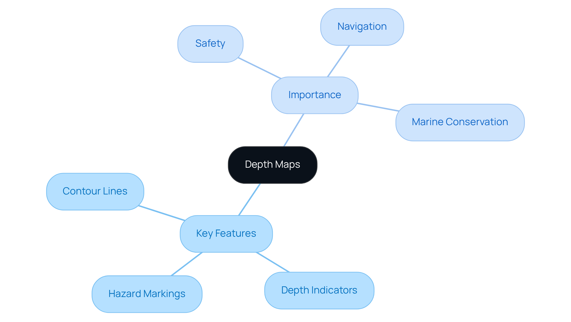
Depth charts are specialized depictions that illustrate the underwater terrain of lakes and oceans, such as the depth map of Lake Superior, revealing variations in measurement across different regions. These charts are essential for activities such as fishing, boating, and diving, as they provide critical insights into the underwater landscape. The significance of underwater charts lies in their ability to deliver vital information regarding water levels, submerged structures, and potential risks, greatly enhancing safety and enjoyment during water-based activities. By familiarizing yourself with the depth map of Lake Superior and elevation maps, you can make informed choices about where to explore, ensuring a more fulfilling experience.
Key Features of Depth Maps:
- Contour Lines: These lines indicate depth changes, helping users visualize the underwater terrain.
- Depth Indicators: Numbers on the map represent the depth at specific points, allowing for precise navigation.
- Hazard Markings: Depth charts often highlight areas to avoid, such as shallow regions or submerged rocks, which is essential for safe navigation. Bathymetric charts, for instance, can reveal hidden dangers that may not be visible from the surface, promoting safer navigation for both boaters and divers.
Understanding these components will enable you to utilize dimensional charts effectively in your expedition preparation. Furthermore, bathymetric charts play a crucial role in marine conservation by aiding in the identification of vital habitats and underwater characteristics that support biodiversity. Integrating user experiences, such as those shared by anglers who have successfully navigated unfamiliar waters using underwater charts, further illustrates their practical advantages.

Explore Lake Superior's Depth Map Features
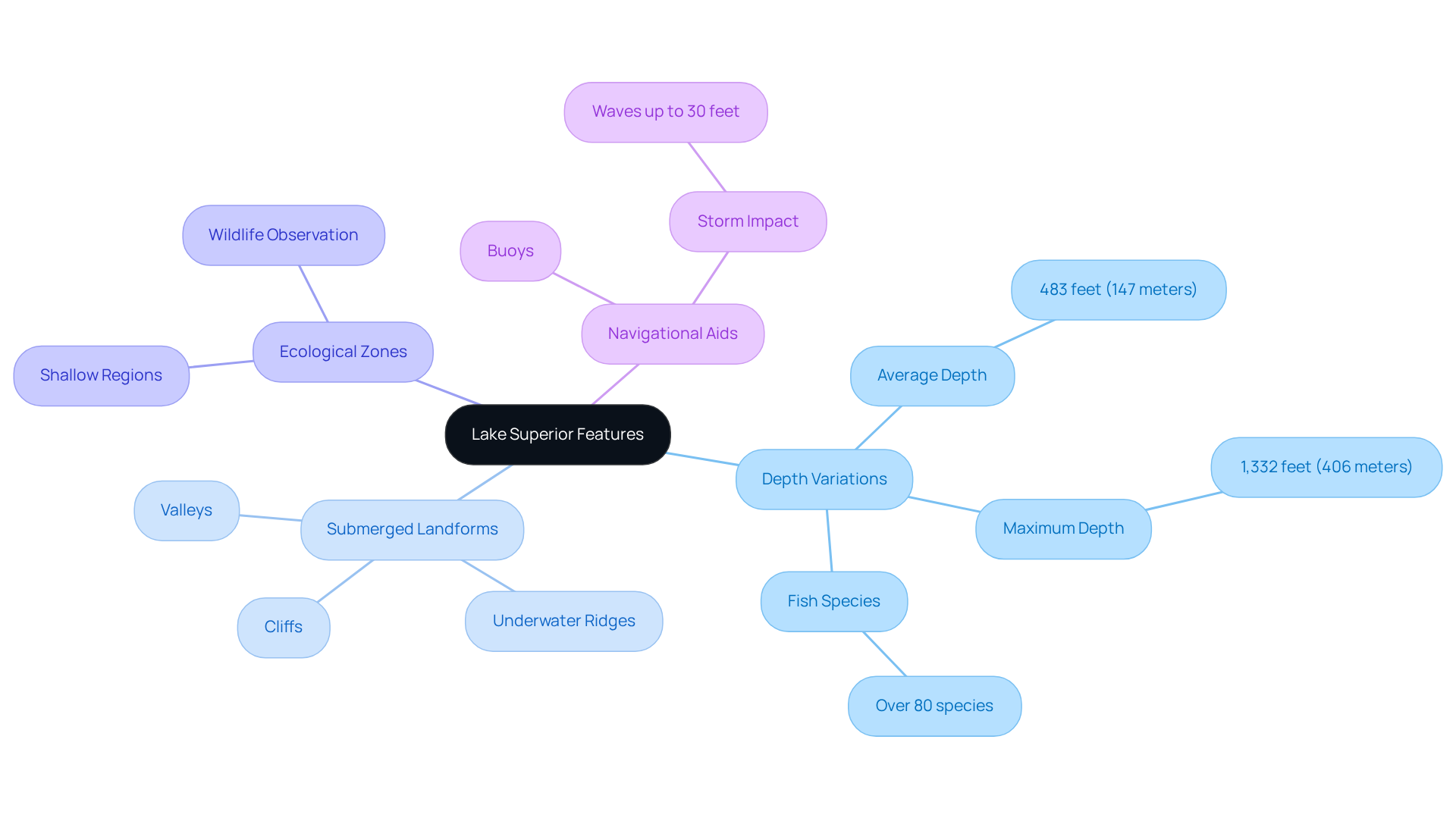
The map of Superior's basin reveals a treasure trove of unique characteristics that enhance a variety of adventure activities. Notably, the depth variations of the lake can be observed in the depth map of Lake Superior. The depth map Lake Superior shows an average depth of 483 feet (147 meters) and a maximum depth of 1,332 feet, which are crucial for fishing and boating. They create diverse habitats that support over 80 species of fish, establishing Lake Superior as a prime location for anglers. Furthermore, it holds 10% of the world's surface fresh water that is not frozen in ice caps or glaciers, underscoring its ecological importance.
Additionally, the submerged landforms of the lake's floor are characterized by underwater ridges, valleys, and cliffs, which can greatly influence navigation and fishing spots. Familiarizing yourself with these submerged features enhances your adventure experience, allowing for more strategic planning. The depth map Lake Superior often includes markers for buoys and other navigational aids, which are essential for safe travel across the lake. Understanding these aids is vital, especially given the lake's notorious storms that can produce waves up to 30 feet, emphasizing the need for careful navigation.
Moreover, the ecological zones within the lake support diverse ecosystems, with shallower regions promoting abundant aquatic life. Knowing the locations of these ecological zones can aid in planning activities such as snorkeling or wildlife observation, ensuring a more fulfilling experience. The lake's formation approximately 10,000 years ago from glacial depressions adds historical context to its unique geological features.
By exploring these features, you can effectively organize your experiences on Lake Superior, maximizing both enjoyment and safety in this stunning natural wonder.

Interpret Depth Map Data: Step-by-Step Guide
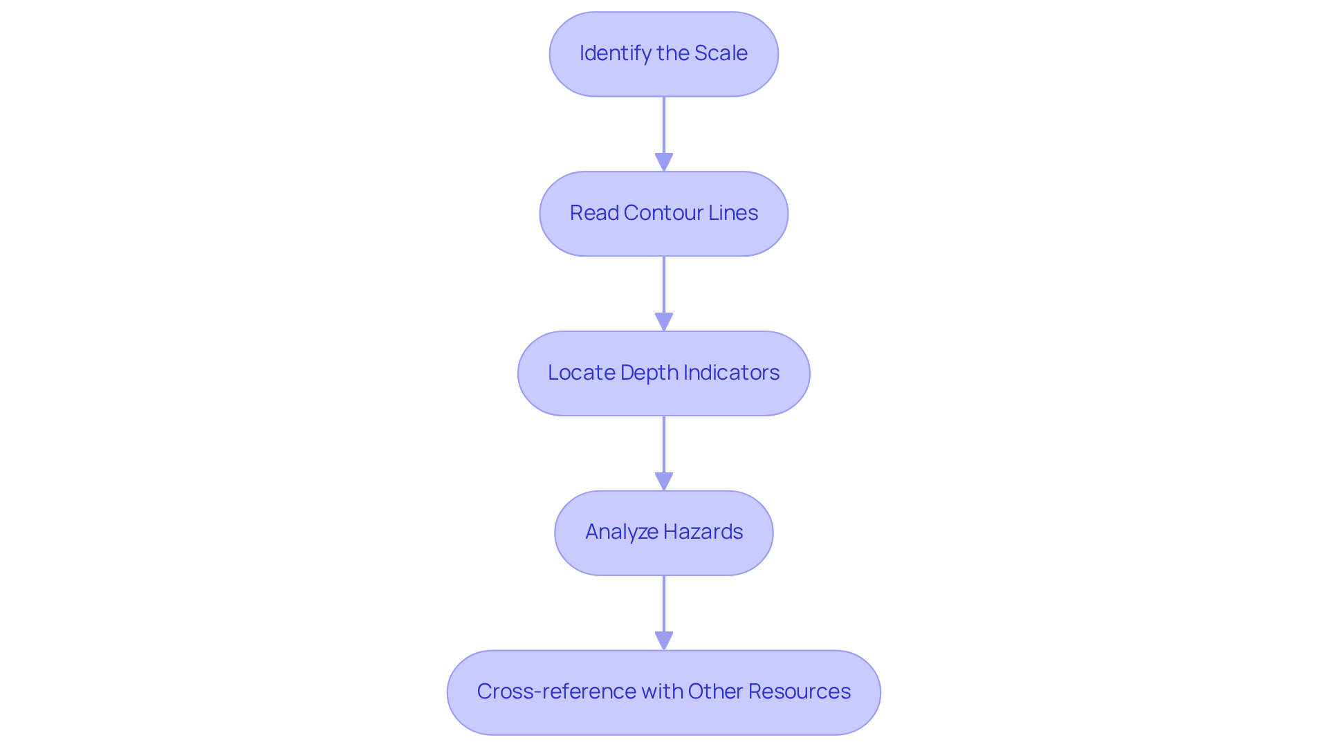
Interpreting elevation map data is a crucial skill that can significantly enhance your adventure planning. By mastering the following guide, you will effectively read and analyze the depth map Lake Superior, ensuring safer and more enjoyable experiences.
- Identify the Scale: Begin by checking the scale of the map. Understanding the distance represented is essential, as it enables you to gauge the size of the areas you are examining.
- Read Contour Lines: Observe the contour lines closely. Lines that are close together indicate steep drops, while those that are spaced apart suggest gradual slopes, providing vital information about the terrain.
- Locate Depth Indicators: Look for the numbers on the map that signify underwater measurements. These indicators will help you identify shallow and deep areas, which is crucial for safe navigation.
- Analyze Hazards: Pay attention to any markings that indicate hazards. These may include rocks, shallow spots, or other barriers that could pose risks during your journey.
- Cross-reference with Other Resources: Utilize supplementary materials, such as local fishing reports or boating guides, to enhance the information gleaned from the contour map. This additional context can provide insights into the best spots for your activities.
By following these essential steps, you will be well-prepared to analyze terrain charts proficiently, leading to safer and more enjoyable adventures.

Apply Depth Map Insights for Adventure Planning
Now that you comprehend the intricacies of dimensional maps and their interpretation, it is time to channel this understanding into your adventure planning. Here’s how to effectively harness depth map insights:
Adventure Planning Steps:
- Select Your Activities: Determine the activities you wish to engage in, such as fishing, kayaking, or diving. This selection will influence which regions of the map hold the most significance for your plans.
- Identify Key Locations: Leverage the terrain map to locate ideal spots for your chosen activities. Seek out areas with beneficial measurements and characteristics that align with your goals, such as submerged structures that attract fish.
- Plan Your Route: Using the contour map, chart a course that circumvents hazards and enhances your overall experience. Take into account factors like water currents, weather conditions, and the average depth map of Lake Superior, which is 483 feet, with its deepest point reaching 1,332 feet.
- Gather Necessary Equipment: Ensure you are equipped with the appropriate gear for your outing, whether it involves fishing rods, diving equipment, or safety gear for boating. The right equipment can significantly elevate your experience.
- Check Local Regulations: Prior to your departure, familiarize yourself with any local regulations regarding fishing, boating, or other activities on Lake Superior to ensure compliance.
By implementing these insights, you can formulate a comprehensive exploration plan that utilizes the valuable information provided by the depth map Lake Superior, culminating in an unforgettable experience. As adventure planner Frank Wolf aptly states, "Happiness is being in the midst of an adventure, when past and future are irrelevant and there is only now.
Conclusion
Understanding and utilizing depth maps, particularly the one for Lake Superior, is essential for anyone looking to enhance their outdoor adventures. This guide has illuminated the importance of these specialized charts, showcasing how they provide vital information regarding the underwater terrain, crucial for activities such as fishing, boating, and diving. Mastering the interpretation of depth maps empowers adventurers to make informed decisions that enhance both safety and enjoyment.
Key insights discussed include essential features of depth maps, such as:
- Contour lines
- Depth indicators
- Hazard markings
These features collectively inform users about the underwater landscape. The depth map of Lake Superior, with its impressive depth variations and unique submerged features, presents a wealth of opportunities for exploration and adventure. By following a structured approach to reading and applying depth map data, adventurers can navigate the lake's challenges while maximizing their experiences.
Ultimately, the significance of depth maps extends beyond mere navigation; they serve as a gateway to fully experiencing the natural wonders of Lake Superior. Whether planning a fishing trip, a kayaking expedition, or simply exploring the lake's ecological zones, leveraging the insights from depth maps can lead to unforgettable adventures. Embrace the journey of discovery and make the most of every moment spent on this breathtaking lake by utilizing the depth map as your essential guide.
Frequently Asked Questions
What are depth maps and why are they important?
Depth maps are specialized depictions that illustrate the underwater terrain of lakes and oceans. They are important for activities such as fishing, boating, and diving because they provide critical insights into the underwater landscape, including water levels, submerged structures, and potential risks.
What key features are found on depth maps?
Key features of depth maps include contour lines that indicate depth changes, depth indicators that show specific depths at points on the map, and hazard markings that highlight areas to avoid, such as shallow regions or submerged rocks.
How do contour lines assist users of depth maps?
Contour lines help users visualize the underwater terrain by indicating changes in depth, allowing for better understanding and navigation of the underwater landscape.
What role do depth indicators play in navigation?
Depth indicators are numbers on the map that represent the depth at specific points, allowing for precise navigation and helping users avoid hazards.
How do hazard markings contribute to safety in water activities?
Hazard markings on depth charts highlight areas to avoid, such as shallow regions or submerged rocks, promoting safer navigation for boaters and divers by revealing hidden dangers that may not be visible from the surface.
What is the significance of bathymetric charts in marine conservation?
Bathymetric charts aid in the identification of vital habitats and underwater characteristics that support biodiversity, playing a crucial role in marine conservation efforts.
How can user experiences enhance the understanding of depth maps?
User experiences, such as those shared by anglers who have successfully navigated unfamiliar waters using underwater charts, illustrate the practical advantages of depth maps and their effectiveness in enhancing water-based activities.


